
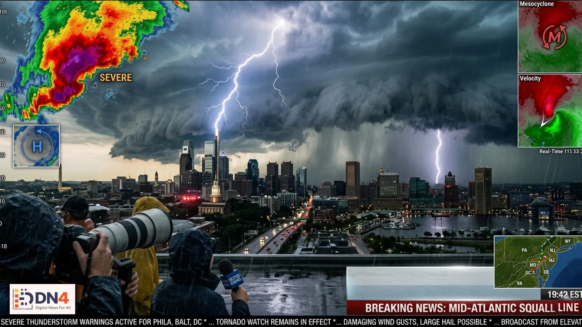
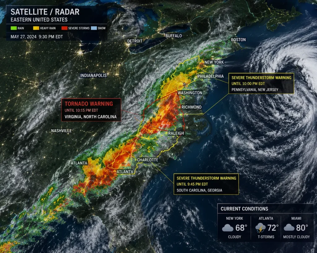
A powerful storm system sweeping across the eastern United States on May 11 has placed millions of residents under a severe thunderstorm watch throughout the Mid-Atlantic region. Meteorologists warn that the developing weather pattern could bring damaging winds, torrential rainfall, dangerous lightning, and the possibility of isolated tornadoes as the front intensifies through the evening hours.
According to the National Weather Service, the unstable atmospheric conditions are being fueled by warm, moisture-rich air colliding with a colder front moving in from the west. Forecasters say the storm system could impact major metropolitan areas including Washington D.C., Baltimore, Philadelphia, and parts of New Jersey and Virginia.
What’s Driving the Severe Weather?
Weather experts at the National Oceanic and Atmospheric Administration (NOAA) explain that strong wind shear combined with rising temperatures has created ideal conditions for fast-moving thunderstorms. Some areas may experience wind gusts exceeding 70 mph, capable of causing power outages and downed trees.
The Storm Prediction Center has categorized portions of the Mid-Atlantic under an enhanced risk level for severe weather, urging residents to remain alert as storms develop rapidly throughout the day.
Flash Flooding Concerns Rise
In addition to damaging thunderstorms, meteorologists are warning of localized flash flooding in urban and low-lying areas. Heavy rainfall rates could overwhelm drainage systems, especially in densely populated cities already saturated from recent rain events.
The Ready.gov flood preparedness guide advises residents to avoid driving through flooded roadways and to monitor local emergency alerts closely. Emergency management teams across several states are preparing for possible rescue operations if flooding worsens overnight.
Travel Disruptions and Power Outages Possible
Air travel across several East Coast airports may experience delays as storm cells move through key transportation corridors. Airlines and transit authorities are closely monitoring weather conditions, particularly around major hubs.
Utility companies are also preparing emergency response crews in anticipation of widespread outages. The Federal Emergency Management Agency (FEMA) recommends keeping backup batteries, flashlights, and emergency supplies readily available in case of prolonged service interruptions.

How Residents Can Stay Safe
- Monitor official weather alerts continuously.
- Avoid outdoor activities during lightning storms.
- Secure loose outdoor furniture and objects.
- Charge mobile devices before severe weather arrives.
- Prepare emergency kits with water and medical supplies.
Live radar updates and emergency notifications are available through the AccuWeather platform and the Weather Channel, both of which continue to track the evolving storm system in real time.
Outlook for the Coming Days
Forecasters expect the storm front to gradually weaken as it moves offshore, though scattered storms may persist into early next week. Climate experts note that increasingly volatile weather events have become more frequent across parts of the United States, raising ongoing concerns about infrastructure resilience and emergency preparedness.
Residents throughout the Mid-Atlantic are encouraged to stay informed and take warnings seriously as severe weather conditions continue developing across the region.
#MidAtlanticStorm #ThunderstormWatch #SevereWeather #StormAlert #WeatherNews #FlashFloodWarning #NOAA #ClimateNews #BreakingWeather