
Breaking: Current Tsunami Event Affects US West Coast
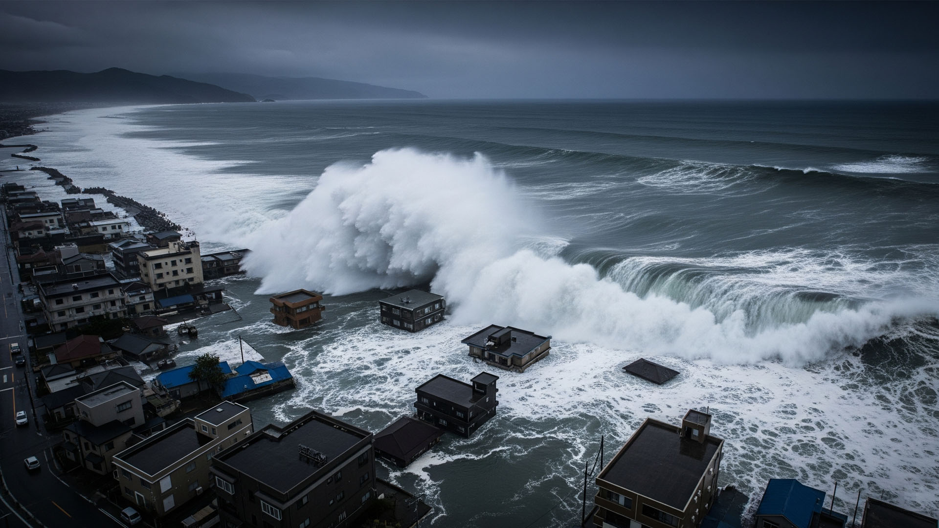
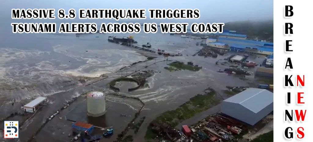
As of July 30, 2025, the United States is experiencing a real-time tsunami event that underscores the ongoing vulnerability of American coastlines to these devastating natural disasters. A massive magnitude 8.8 earthquake struck off the coast of Russia’s Kamchatka Peninsula, triggering tsunami warnings and tsunami evacuations along the U.S. West Coast, Alaska, and Hawaii. Tsunami alerts were issued for Alaska and Hawaii on Tuesday after a major, 8.8 magnitude earthquake struck off the coast of Russia, with tsunami waves already hitting Hawaii and creating dangerous conditions for coastal communities.
For real-time tsunami alerts and official warnings, residents should monitor the National Tsunami Warning Center and NOAA’s U.S. Tsunami Warning System, which provide 24/7 monitoring and tsunami forecasts for all U.S. coastal areas.
This developing situation serves as a stark reminder of how quickly tsunami threats can emerge and impact American communities thousands of miles from the earthquake’s epicenter.
What Are Tsunamis?
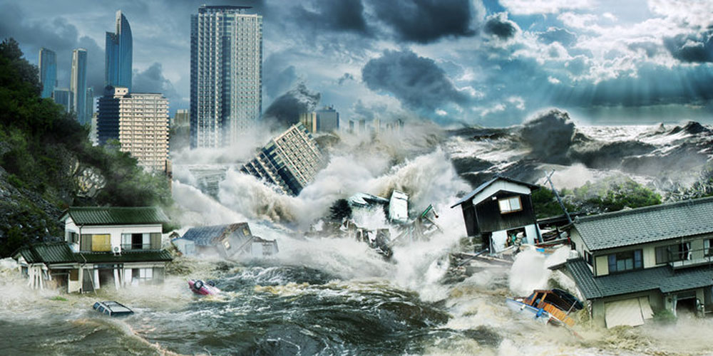
Tsunamis are series of ocean waves caused by sudden, large-scale disturbances of the ocean floor or coastal areas. Unlike regular ocean waves generated by wind, tsunamis are driven by massive displacement of water, creating waves that can travel across entire ocean basins at speeds exceeding 500 miles per hour in deep water.
The word “tsunami” comes from Japanese, meaning “harbor wave,” reflecting Japan’s long and tragic history with these phenomena. However, tsunami hazards pose a significant threat to coastlines worldwide, including extensive areas of the United States. Understanding tsunami science and tsunami preparedness is crucial for coastal communities across America.
How Tsunamis Form
Tsunamis can be triggered by several geological events:
Underwater Earthquakes: The most common cause, accounting for about 80% of all tsunamis. When tectonic plates shift suddenly beneath the ocean floor, they displace enormous volumes of water. The current event affecting the U.S. West Coast exemplifies this mechanism, with the 8.8-magnitude Russian earthquake generating waves that have traveled thousands of miles across the Pacific.
Volcanic Eruptions: Underwater volcanic explosions or the collapse of volcanic islands can generate tsunamis. The 1883 eruption of Krakatoa in Indonesia created waves over 130 feet high.
Landslides: Both underwater landslides and those that fall into water bodies can create tsunamis. Scientists are particularly concerned about potential landslides along the U.S. West Coast and in Alaska.
Meteorite Impacts: Though extremely rare, large meteorites striking the ocean could theoretically generate tsunamis.
Tsunami Characteristics and Behavior
Tsunamis behave differently from ordinary waves in several critical ways:
Speed and Distance: In deep ocean water, tsunamis can travel at jet-aircraft speeds. As they approach shore and water depth decreases, they slow down but increase dramatically in height.
Wavelength: Tsunami waves can be hundreds of miles long, compared to typical ocean waves that are only a few hundred feet in length. This means the wave energy continues for much longer periods.
Multiple Waves: Tsunamis typically arrive as a series of waves, with the first wave not necessarily being the largest. Subsequent waves can arrive minutes or hours apart, and the largest wave might be the third, fourth, or fifth in the series.
Warning Signs: The ocean may recede dramatically before a tsunami arrives, exposing the sea floor. This recession can occur minutes before the first wave hits and serves as a natural warning sign.
America’s Tsunami Risk Zones
The United States faces tsunami threats along multiple coastlines, with varying levels of risk:
Pacific Coast (Highest Risk)
The West Coast faces the greatest tsunami threat due to its location along the seismically active “Ring of Fire.” The current tsunami event demonstrates this vulnerability, with warnings issued from California to Alaska. Key risk factors include:
- Proximity to the Cascadia Subduction Zone, which could generate a catastrophic local tsunami
- Exposure to distant tsunamis from across the Pacific, as evidenced by today’s Russian earthquake event
- Major population centers like Los Angeles, San Francisco, Seattle, and Portland located in potential impact zones
Alaska (Very High Risk)
Alaska’s extensive coastline and high seismic activity make it extremely vulnerable. The state has experienced numerous tsunami events, including the devastating 1964 Good Friday earthquake tsunami that killed over 100 people.
Hawaii (High Risk)
Hawaii’s central Pacific location makes it vulnerable to tsunamis from all directions. The islands have sophisticated warning systems and regularly conduct evacuation drills. Today’s event has already seen waves reaching Hawaiian shores.
Atlantic and Gulf Coasts (Lower but Significant Risk)
While less frequent, tsunamis can occur in the Atlantic and Gulf of Mexico. Potential sources include earthquakes in the Caribbean, landslides, or rare Atlantic seismic events.
The U.S. Tsunami Warning System
The United States operates one of the world’s most advanced tsunami warning systems, managed by the National Weather Service’s National Tsunami Warning Centers. The comprehensive NOAA Tsunami Program includes:
Detection Networks: A network of seismic monitors and ocean buoys that detect earthquakes and measure wave heights in real-time through the DART® (Deep-ocean Assessment and Reporting of Tsunamis) system.
Warning Levels: The U.S. Tsunami Warning System issues different alert levels based on threat severity:
- Tsunami Warning: Immediate threat to life and property
- Tsunami Advisory: Strong currents and dangerous waves expected
- Tsunami Watch: Earthquake has occurred, tsunami possible
Communication Systems: Warnings are disseminated through emergency broadcast systems, tsunami alerts on cell phones, coastal sirens, and social media platforms.
The effectiveness of this system is being demonstrated today, with warnings issued promptly after the Russian earthquake, allowing coastal communities time to prepare and evacuate when necessary. Both the National Tsunami Warning Center serving the continental U.S., Alaska, and Canada, and the Pacific Tsunami Warning Center serving Hawaii operate 24/7 to protect American lives.
Historical Tsunami Events Affecting the United States
1964 Alaska Earthquake and Tsunami
The most devastating tsunami in U.S. history occurred following a 9.2-magnitude earthquake on Good Friday, March 27, 1964. The tsunami killed 106 people in Alaska and 15 more in Oregon and California, demonstrating how far tsunami effects can reach.
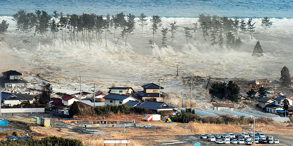
2011 Tōhoku Tsunami
While this Japanese tsunami was devastating in Japan, it also impacted the U.S. West Coast. Oregon and California experienced significant harbor damage, and one person was killed in California. The event caused an estimated $100 million in damage to U.S. coastal areas.
1946 Aleutian Islands Tsunami
A tsunami generated by an earthquake in Alaska’s Aleutian Islands traveled across the Pacific, killing 159 people in Hawaii. This event led to the establishment of the Pacific Tsunami Warning Center.
Tsunami Preparedness and Safety
Understanding how to respond to tsunami threats can save lives. The Federal Emergency Management Agency (FEMA) and Ready.gov provide comprehensive guidance for tsunami preparedness:
Know Your Evacuation Zone: Coastal residents should know if they live in a tsunami evacuation zone and identify evacuation routes and safe areas. Use NOAA’s Tsunami Zone Evacuation Map to determine your risk level and evacuation routes.
Natural Warning Signs: If you feel an earthquake near the coast or see the ocean recede unusually, move to higher ground immediately without waiting for official warnings. This is nature’s tsunami warning.
Evacuation Protocol: When tsunami warnings are issued, move inland and to higher elevation quickly. Follow the “100 feet up or 1 mile in” rule – seek shelter 100 feet or more above sea level, or at least one mile inland.
Emergency Supplies: Coastal residents should maintain tsunami emergency kits with food, water, medications, and important documents. Washington State recommends being “2-Weeks Ready” for tsunami preparedness.
Stay Informed: Monitor official sources for warnings and updates, such as NOAA Weather Radio, the National Weather Service, and local emergency management agencies.
Vertical Evacuation Structures: Some coastal areas now feature specially designed tsunami towers and vertical evacuation buildings. Washington State’s Pacific coast includes Project Safe Haven structures capable of withstanding 9.0+ magnitude earthquakes and 30-foot waves.
Current Preparedness Initiatives
The United States continues to enhance tsunami preparedness through various programs:
TsunamiReady Communities: NOAA recognizes communities that meet specific preparedness criteria, encouraging local tsunami awareness and response capabilities.
Education and Outreach: Programs like Tsunami Preparedness Week, which occurred in March 2025, help educate coastal communities about tsunami risks and safety measures.
Infrastructure Improvements: Continued investment in warning systems, evacuation route signage, and emergency response capabilities.
Research and Modeling: Ongoing scientific research helps improve understanding of tsunami generation, propagation, and coastal impacts.
Economic and Environmental Impact
Tsunamis can cause devastating economic and environmental consequences:
Economic Damage: The 2011 Tōhoku tsunami caused billions in damage to U.S. coastal infrastructure, despite being a distant event. A major local tsunami could cause catastrophic economic losses.
Environmental Impact: Tsunamis can alter coastlines, destroy marine ecosystems, contaminate freshwater supplies, and deposit debris far inland.
Recovery Challenges: Coastal communities may take years or decades to fully recover from major tsunami events.
Looking Forward: Climate Change and Future Risks
Climate change may influence future tsunami risks in several ways:
Sea Level Rise: Higher baseline sea levels could increase the inland penetration of tsunami waves.
Coastal Development: Continued development in coastal areas increases the population and infrastructure at risk.
Glacial Instability: Warming temperatures could increase the risk of landslide-generated tsunamis in places like Alaska.
Today’s tsunami event affecting the U.S. West Coast serves as a powerful reminder that tsunamis remain a significant natural hazard for American coastal communities. While the current situation demonstrates the effectiveness of early warning systems, it also underscores the ongoing need for preparedness, education, and respect for the ocean’s power.
The United States has made substantial progress in tsunami preparedness since the devastating events of the past, but continued vigilance and investment in warning systems, community preparedness, and scientific research remain essential. As coastal populations continue to grow and climate change presents new challenges, understanding and preparing for tsunami risks becomes increasingly important for protecting American lives and communities.
For the most current information on today’s tsunami event and ongoing warnings, residents in affected areas should monitor official sources including the National Weather Service, local emergency management agencies, and trusted news outlets. Remember that tsunami threats can persist for hours after the initial event, and multiple waves may arrive over time.